Patricia Leach is the Board President of the Williamstown Historical Museum and served five years as Director of Development for the Delaware Center for the Contemporary Arts. She taught for twenty-three years in the Department of Art at Williams College, and earned a PhD and MFA in Art and Archaeology from Princeton University. At present, her research centers on eighteenth-century American and European history and art.

July 4–October 10, 2016

proprietors book and surveyor's chain

Surveyor’s Chain, late nineteenth/early twentieth century
Lent by Tom Merrill
Proprietors Book of the west Township at Hoosuck
Lent by the Town of Williamstown
TRANSCRIPT:
On December 5, 1753 the proprietors of the “west Township at Hoosuck,” as Williamstown was then known, gathered in the home of Dr. Seth Hudson to launch a local government—voting on officials and committees and levying small fees to pay expenses incurred as the “proprietry" carried out its business. The group also voted to raise ten shillings (one half of a Massachusetts pound) to pay for a proprietors book in which the town’s records would be kept until the beginning of the next century. The book is the earliest original town document surviving in Williamstown, of which Arthur Latham Perry, nineteenth century Williams alumnus and professor, wrote:
“It is thus that we learn in detail through a single example, the best lesson that New England has had of teaching to the world at large. The roots of all our civil politics, municipal and state and national, are uncovered and displayed. . . . [in our] humble magna charta . . .”
The organization of a village and government had been approved on September 10, 1753, and a meeting of the proprietors was called to “determine upon a division of land or part of the lands in said township.” Over the course of years to come, lands were divided many times and in a number of ways. About a quarter of the first lots were offered to soldiers from Fort Massachusetts in lieu of pay in cash, while many others were sold via lottery in the eastern part of the bay colony. Some of the other first lots were sold to settlers from Canaan, Wethersfield, and New London, Connecticut. Further divisions of lands were devised to equitably allot the natural resources of the township so that each of the proprietors received a share of fresh meadowland, prime agricultural land, other agricultural lands, pine woodlot, oak woodlot, and forested land on steep slopes. Lots were measured using a surveyor’s chain, and the measurements were recorded in this book.
About the surveyor’s chain:
Surveyor’s Chain, late nineteenth/early twentieth century
Manufactured by W. & L.E. Gurley, Troy, NY
Steel and brass
Lent by Tom Merrill
This type of surveyor’s measurement is called a Gunter’s chain after the seventeenth-century English mathematician who designed it. The chain is sixty-six feet long and comprised of 100 links, each measuring 7 7/8 inches. An acre of land comprises ten square chains in the Gunter system. The land in Williamstown was initially surveyed and plotted using a surveyor’s chain such as this.

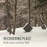
Recovering Place: Reflecting on Stone Hill
By Mark C. Taylor
An illustrated book chronicling the land art and sculptures created by Mark C. Taylor at his home in the Berkshire hills, echoing themes found in the exhibition. Supported in part by Herbert A. Allen, Jr. and the Clark Art Institute and published by Columbia University Press. Call the Museum Store at 413 458 0520 to order.